Garmin Navionics+™ NSSA012R Brazil
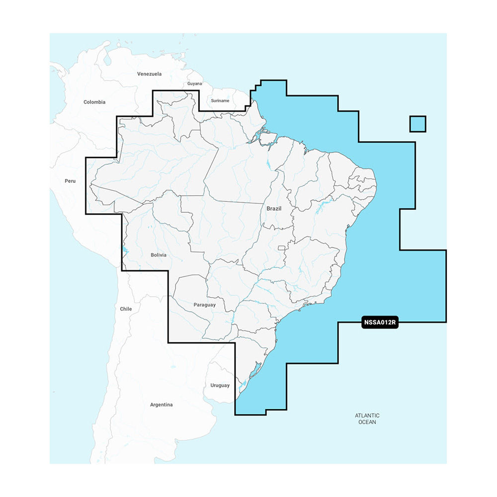
<p><strong>Navionics+™ NSSA012R Brazil</strong></p><p>Featuring vibrant colors, a streamlined interface, and combined coastal/inland content with a popular Navionics® style color palette, Garmin Navionics+ cartography makes it easy to plot courses with the world’s No. 1 name in marine mapping.</p><ul><li>microSD™/SD™ format</li><li>Navigate with the best offshore and inland lake coverage for a Garmin chartplotter</li><li>Customize the view with various chart layers and overlay combinations</li><li>With the included one-year subscription, access daily updates via the ActiveCaptain® smart-device app</li><li>Auto Guidance+™ technology2 lets users navigate with suggested dock-to-dock routings</li><li>Select up to 10 color-shaded target depth ranges to scope out the best fishing spots</li><li>Save money by renewing the subscription — and continue accessing daily updates plus new content downloads</li></ul><p><strong>Coverage</strong></p><p>Detailed coverage of the coast of Brazil. Also including the Amazon River from Benjamin Constant to the Atlantic Ocean.</p><p><strong>All-In-One Map Solution for Garmin Chartplotters</strong></p><p>Access detail-rich mapping of coastal features, lakes, rivers, and more. Integrated Garmin and Navionics® content offers coverage for boaters worldwide.</p><p><strong>Daily Chart Updates</strong></p><p>Charts are constantly being enhanced with new and amended content — as many as 5,000 updates are made every day. The one-year subscription includes access to daily chart updates via the ActiveCaptain app.</p><p><strong>Auto Guidance+ Technology</strong></p><p>Combining the best of Garmin and Navionics automatic routing features, built-in Auto Guidance+ technology2 gives users a suggested dock-to-dock path to follow through channels, inlets, marina entrances, and more.</p><p><strong>Depth Range Shading</strong></p><p>High-resolution depth range shading lets users select up to 10 color-shaded options and view the designated target depths at a glance.</p><p><strong>Up to 1’ Contours</strong></p><p>For improved fishing and navigation, up to 1' contours provide a clear depiction of bottom structure for improved fishing charts and enhanced detail in swamps, canals, harbors, marinas, and more.</p><p><strong>Shallow Water Shading</strong></p><p>To give a clear picture of shallow waters to avoid, this feature allows for shading at a user-defined depth.</p><p><strong>ActiveCaptain Community</strong></p><p>Community-sourced content provides useful POIs, such as marinas, anchorages, hazards, businesses, and more. Get recommendations from boaters with firsthand experience of the local environment.</p><p><sup>1</sup>Auto Guidance+ is for planning purposes only and does not replace safe navigation operations</p> <!--- cis2:mm5sl5hm --->
